Lescudjack
BayOfPlenty

Lescudjack

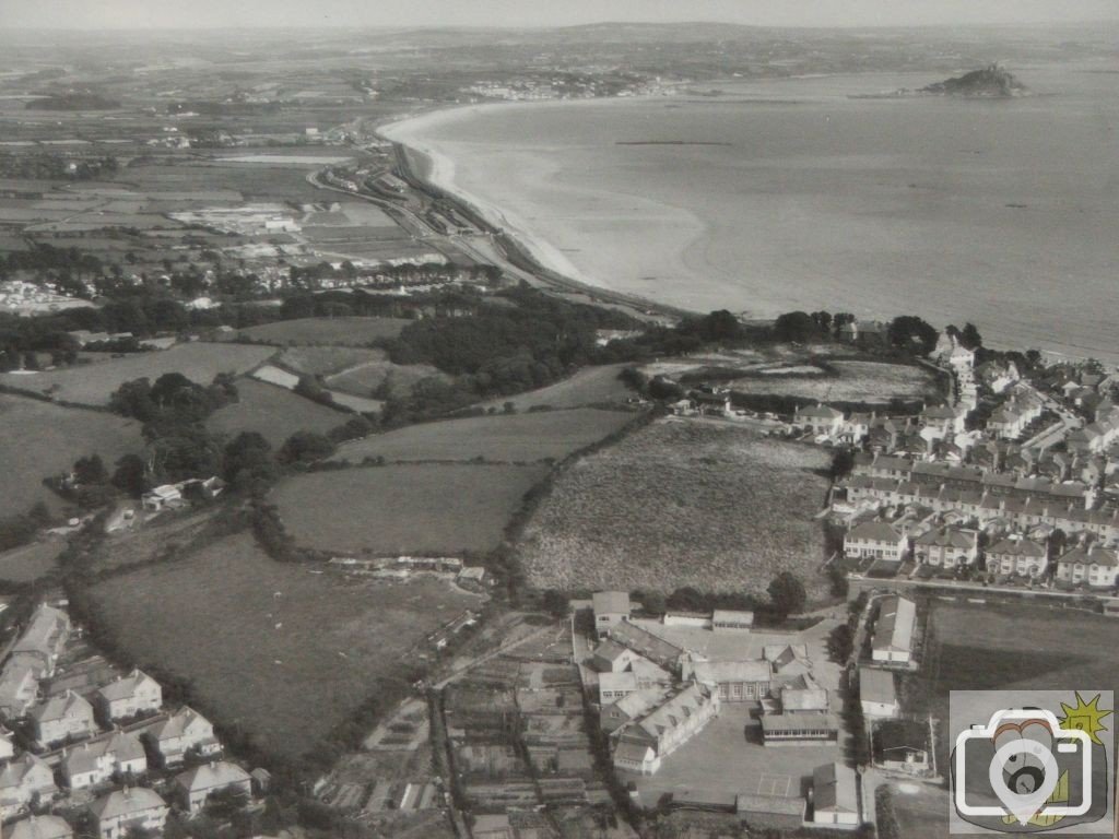
Aerial view of this area, interesting to compare with the other photos of the school. Judging by the number of school buildings I'd hazard a guess that this was taken in the 60s. Also, note that Peverell Road and part of Treneere are visible, although the infants' school hasn't yet been built.
A lovely view...of the surrounding area as well..good pic...I reckon the date is around 1958......
 
Fantastic pic, BoP! Didn t know you could fly! Where did you find this? Could you move the camera to the right a bit and show the top corner of the Rec to show what the lie of the land was like before we moved in?
 
I can see (...) Hall s piggery top left of Lescudjack (he also had a dairy at the bottom of Market Jew Street)
 
Thank goodness someone has a copy of this picture! This hung near the office in the lower site of Humphry Davy school, and always fascinated me. When the lower site was closed and demolished the photo ended up in Pensans Infants School. That school closed a year and a half ago and before I could take a digital snap of it on my next visit, it was removed! How did you get it BoP? So much to see in this pic, from an undeveloped Eastern Green and absent Pendennis Road to my parent s house in Harbour View Cres!
 
Is that the Heliport landing area in the photo? Does not show the part reclaimed land area, seems to be filled in and grassed.
 

Media information

Album
Around & about
Added by
BayOfPlenty
Date added
View count
1,941
Comment count
7
Rating
0.00 star(s) 0 ratings

Share this media

Top Bottom