You are using an out of date browser. It may not display this or other websites correctly.
You should upgrade or use an alternative browser.
You should upgrade or use an alternative browser.
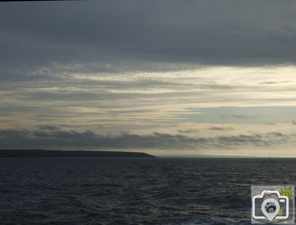


Across Lyonesse - 34
A look back as we enter the shadow of cloud, and cross the Land of Lyonesse.
Notes now added below, on the Land of Lyonesse.
23rd May 2009
Lyonesse
[pronounced: lion-ess]
The present Isles of Scilly show by evidence that they were once a single land mass (island);
It appears from Roman reports and from evidence on Nornour that there was a major inundation 370 AD of 3.5 metres,
perhaps sand and soil of some lower regions of the land mass, removed by storms;
Names (not the later saints names) of islands that have persisted have their origins in Cornish and relate to features of a single island.
By 1100 the new three land masses became separate islands, the remaining ancient hilltops.
This is in no doubt from archaeological exploration.
My grandfather knew of those who could (at the correct tides and currents) wade from island to island,
along the sandbars, from St Mary’s (Bar Point) to Tresco, and then to Bryher and to Samson, or from Tresco to St Martins via Tean.
However, we must be careful not to confuse ancient Scilly with legendary Lyonesse.
It was during the later period that an inundation was recorded on British Coasts right to the Thames,
in the great storms of 1014 and 1099;
It is also known that Gwavas Lake became inundated and absorbed into Mount’s Bay.
That does seem to align with the present floor of the Bay,
particularly remembering the changes that would have been happening over the years since that event.
It must be borne in mind that it is an ancient name for that area of the Bay
and therefore has some credance, in view of later writings on discoveries made here.
Whether or not this happened overnight or gradually, it nevertheless happened.
Whatever soil, or sand was deposited on the ancient rocks has been eroded and has become a part of the sea bed,
whilst the seal levels rose by virtue of general rise and by isostatic change.
Other reasons for sudden change were storms and storm surges, meteor falls (evidence for that exists),
tsunamis (evidence is strong for one occurring in 1607 to the Bristol and South Wales region)
by reason of earthquake or continental shelf event or sub-marine landslide (evidence for those exists on the Celtic Fan).
The nature of Cornwall is such that a great length of the Cornish coast is granite cliffs,
but, these lands continued at some time previous down into the sea,
those areas being eroded, over what length of time is nigh indeterminate.
A Dutch 17th century map marks the Seven Stones as Gulfe, described then as ‘a land which sank’ -
this 'myth' is not some fanciful invention of a Victorian mind - it is written of by Sir Thomas Malory c1470
and based upon the legends of the time, of Wales, Scotland, Cornwall and Brittany.
Those legends and tales are based (with local folklore) upon the events as recorded by
Marianus Scotus [Irish monk moved to Koln and Mainz] in his Chronicon Universale, written c1082;
this was used in the later work by Florence of Worcester a monk who died 1118,
the ‘book’ taken up by John of Worcester and completed c1125.
The Anglo-Saxon Chronicles are formed of MSS of Winchester, Abingdon, Worcester, Peterborough and Canterbury.
For 1014 the Canterbury MS ‘in this year [1014 under King Knut]
on St Michael’s Eve [28th September] that a great sea flood came widely through this country
and ran further inland than it ever did before, and drowned many settlements and a countless number of human beings’.
Peterborough MS for 1099 [under King William Rufus] states
‘ on the Feast of St Martin [11th November]; Florence of Worcester states it was on the 3rd November;
‘the tide rose so strongly and did so much damage as no one remembered it ever did before,
and there was a new moon on the same day’. Here we have Recorders assembling Annals for the Royal Household,
anything beyond things like raids and shipping movements would have to be of major import. Specific days were recorded.
Why was the island of Brechiek renamed after its church’s saint of St Martin in the 16th century?
To give thanks for salvation of the inhabitants?
Breyer became Bryher; Ek Enes became St Agnes.
Whether or not the stories of Brittany [Duarnenez] and in South Wales [Cantref y Gwaelod]
were absorbed into general history as an amalgum or that they were three separate events with
a common reason is a matter for debate. But each place reports sych an event at around the same time, c550 AD.
Let alone general rise in sea levels, as far as isostasis is concerned taking 1.7mm/yr for the area of the sea off Land’s End.
Take a basic date of 550AD in relation to 2009AD.
That is a period of 1450 years. That is less than 3 metres. But to an island with low lying land and dunes, in storm conditions,
it could well be either slowly encroached upon and eroded, or suddenly inundated.
I believe that something drastic happened on more than one occasion, as well as gradual sea rise and erosion.
It need not have been the cataclysmic event of an earthquake with the islands and land disappearing beneath the waves,
but, land has been eaten from the cliffs of Penwith, the depth of sea there ranges to 80 metres;
rather too much to be explained by anything less than a sudden and massive upheaval and that would show evidence, which is not there.
The fact of sub-marine granite towers existing in these waters, (let alone the geological evidence)
indicates to me that the shafts originally extended within a solid landscape, before the sea levels rose and covered them.
In which case that event took pace long before man and his memory.
Even the Celts who arrived here c600BC had their own ‘other-world’ stories of a ‘better land’ in a parallel world,
where a person could transfer between the two times,
perhaps it was an invention of theirs to describe the mystery of the landscape they inhabited on their misty moors.
Or perhaps it was a tale handed down by the people who lived here before?
However, it has been my experience that legends, myths and historical tales, more often than not contain a portion or basis of truth.
Raymond Forward
