Albert Pier, Penzance
treeve

Albert Pier, Penzance

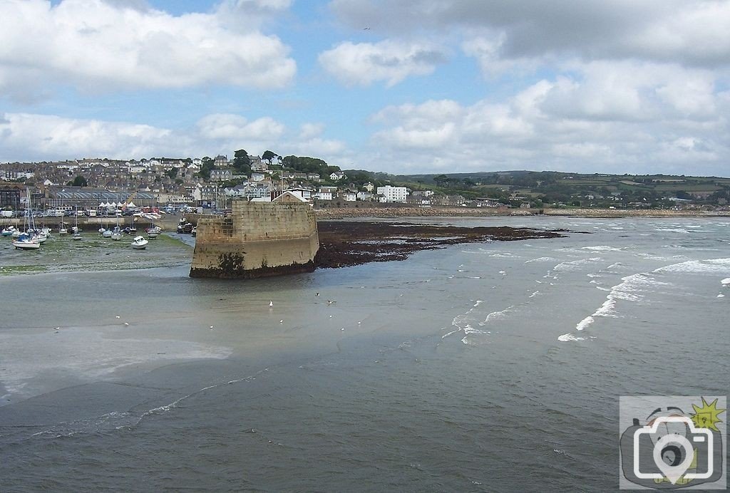
Tide returning from a low ebb, which exposed the sand bank and the rocks to the east of Albert Pier (completed in 1847); it will be interesting to see just how Scillonian IV gets in to the new quay over those rocks. It will also be interesting to see the insurance claims from berthed yachts that have their hulls damaged, as they settle on these rocks and weed. Bear in mind that the width of the rocky area is half the width of the proposed marina. The tide can lower by 3 or 4 feet below this.
I have no doubt that all those problems can be solved, but at what cost to the environment and to our history. More to the greater point is the way in which no one has considered the current flow, the entry into the harbour, the extraordinary ship handling to get in to safe haven. The only safe way into harbour in any serious weather or even weather has been from the east, along the wave line. The scheme allows for a northern course, smack into the main harbour wall, or into the Jubilee Pool.
 
Just about in line with the end of the Albert pier, to the east are two submerged rocks in just three feet of water at LWOT (ordinary low tide); although a channel has been cleared for Scillonian and deep draught vessels, to either side of the channel, the sea bed is just 5 to 8 feet below LWOT. LWOT is a 15 ft tide. Equinoxial tides are 21 ft, with additional height from solar/lunar perihelion and wind coincidence, as well as abnormal ocean behaviour and atmospheric pressure.
 

Media information

Album
Smoke on the Water
Added by
treeve
Date added
View count
2,231
Comment count
3
Rating
0.00 star(s) 0 ratings

Share this media

Top Bottom