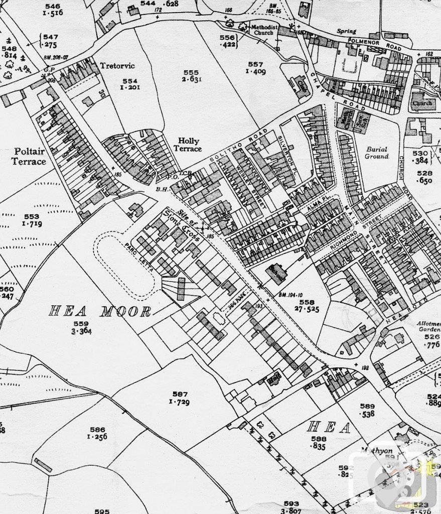
Oh, I can t tell you how very interesting I find these maps - to see the gradual progression of the roads of houses across green fields, over a period of time.
Interesting to see which houses and estates have been built subsequent to this map.
I suspect eventually the 1962 OS will be released from copyright; I am glad that the maps are so interesting. My trouble is that I have so much and I dig into it every now and then, and it does not get put back where it should be and it gets mislaid for months; no point at all in it being here if no one else can see it.
The ‘L’ shaped building down in the corner of Poltair Terrace was a blacksmiths shop. Access to the shop and surrounding ground was not made up and, churned by horses, tended to be muddy. The smithy overcame this over time by sprinkling waste iron filings over the area in front of his main doors. The resulting coalescence was an extremely strong and a cheap wet weather-working space. Might have proved to be a problem to future developers.
This site uses cookies to help personalise content, tailor your experience and to keep you logged in if you register.
By continuing to use this site, you are consenting to our use of cookies.