The bend at Alverton Bridge
treeve

The bend at Alverton Bridge

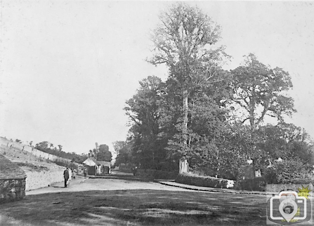
To the left, the old lean-to of what is now named Tredarvah Farm, it was never a farm and the name Tredarvah was brought to this area when the Harvey Family moved from Hayle (c1885) to build their house on the land on the Weeths, seen on the left on the rising land. Between the cottage ground and the Weeths is a pathway, which rose around the hill to gain access to the water supply channel. There is a picture of the steps and pathway here in the albums. The name Tredarvah Farm did not appear until around 1908. The Harvey Family were living in Trevear, Alverton Terrace whilst the House was being built. As a matter of interest, the same decorative treatment on the external walls of Tredarvah House may be seen on another house in Penzance. On the roadside can be seen a cottage and store, demolished for road widening.
Picture about 1885
  • Like
Reactions: md5299
I was so pleased when I had this sent to me; most of it covered. It is fascinating to see the map brought to life in the round . ::15:
 
What is on the right, in Parcel 2137? I know there s a gateway there still, behind where the big tree is, but can I make out the ridgeline of a thatched dwelling behind the fancy gate?
Or am I seeing things that aren t there?
 
I have been trying to enhance that area; I will let you know; the house can be seen through the trees, but there was no building marked in that field that I know of - watch this space. I am curious as to why the gateway, I have to say. The stone wall further along is still there; the whole area took my interest upon seeing Blight s painting (mind you the curator had no idea it was looking or on which side the bound stone was placed).
 
It is an illusion, the sunlight is striking the trunks and branches in such a manner that it looks like a thatched roof; the gate is also fairly elaborate, made in the rustic manner with steam formed branches; that field has been historically wet and only in recent years was it changed to use as a horse paddock; as with the land near Hawke s Farm which sloped down to the sea, the Weeths here used to slope down to the brook, only to be scored by the old track to St Just, up the hill. When I get some decent pictures of the bridge from river level, I will be able to work out just what happened here; I suspect that I will have to walk the river bed again, but with my spine in the shape it is now, that would be foolhardy. I made a note of the subsoil when excavations were being undertaken recently in the road, a habit of mine.
 
It is the combination of slipped discs, arthritis and sinovial tube inflammation on the nervous system - not a cripple, but the legs just decide to give up their appointed function - it passes with rest; I tend to look quite drunk as I walk. It is easing now, thank you.
 
Well I m always impressed when you upload an image...... this time it s historical, educational and dam right entertaining.Thank you once again treeve!
 
I m trying to reconcile this photo to how it is today and I am having trouble. Will need to do a comparison!
 

Media information

Album
Time past
Added by
treeve
Date added
View count
2,649
Comment count
14
Rating
0.00 star(s) 0 ratings

Share this media

Top Bottom