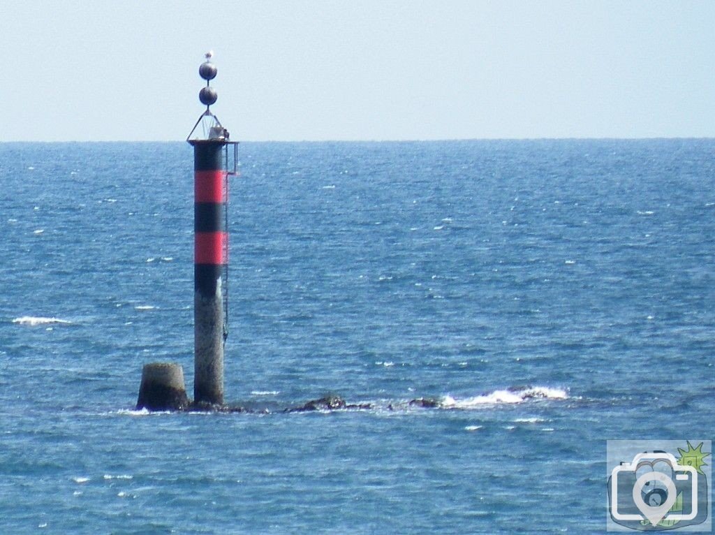
Taken when the tide was at 3 feet ie, 6 feet below Newlyn Datum.
Newlyn Datum is at Mean Sea Level, the mean between HWM and LWM of Ordinary Tides, a level set by survey between 1915 and 1921.
Standing on The Promenade, at 22 feet above MSL, my eye level would be at 27.5 feet above MSL.
Note the coincident Horizon Level and the top of the Pole itself. That gives the height of the column.
The base of the old Pole, which had a ball cage at its head, is still in position. It was set at the northern end of the rocks as they show at Low Tide. The rocks at Low Tide are 30 feet long to the south.
At the time of the photograph, the height of the pole is 27.5 feet plus 6 feet, that is a column height of 33.5 feet, including the rock seen..
Proportion gives that the upper GPS assembly is another ten feet.
As a matter of interest, Horizon at Promenade Level to the eye line is a distance of 6.4 miles.
From Kenegie gateway it is 21 miles. From Chapel Carn Brea it would be 31 miles.