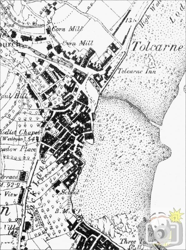
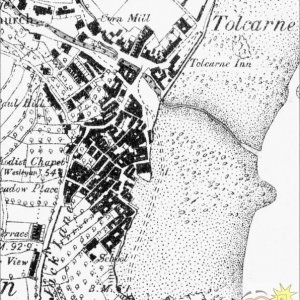
1875 Ordnance survey map of Newlyn; the North pier was completed 1888, the south pier one year before. Note the beach route connection between the two parts of Newlyn (trepolpen's gallery has a picture of this).
130 years ago Newlyn would have been almost unrecognisable. No piers, no New Road, no Strand... What do the shaded area near the number 13 signify, I wonder? This is in the area of the art gallery and fisherman s statue today.
This site uses cookies to help personalise content, tailor your experience and to keep you logged in if you register.
By continuing to use this site, you are consenting to our use of cookies.